Viking Tour 2008 - Prolog
Profile [
Inverse profile
]
Map [
Full screen
]
Loading map....
Download GPS track for this route
Route data
Added by
asbjorjo
Ridden
19.07.2008
Distance
5,8 km
Ascent
342 m
Descent
2 m
Lowest point
11 m
Highest point
352 m
Comments
Be the first to add a comment to this route
Your name
Ride date
If you have already ridden this route, you can fill in the date you did so here. This will help other users determine if your experiences still apply. Fill in the date with this format: M/d/yyyy
Comment
To verify that you're a normal user and not a spam robot, please enter the two words from the image below in the text box. If you cannot read the words, click the refresh button (the upper button of the three buttons next to the text box) to get new words.
Ride times
Your speed
Your time
20 kp/h
00:17:21
25 kp/h
00:13:53
30 kp/h
00:11:34
35 kp/h
00:09:55
40 kp/h
00:08:40
Places
Norge
Sogn og Fjordane
(County)
Vik
(Municipality)
Photos
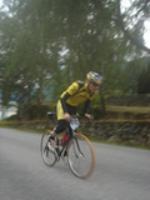
Roger gir jernet over den første kneika.
Back
Go to country
Belgia (13)
Frankrike (4)
Luxemburg (4)
Nederland (1)
Norge (89)
Portugal (4)
Spania (16)
Storbritannia (1)
Tyskland (10)
Østerrike (1)
Advanced search
Contact editor
Energibarrer med koffein
kr 17 pr stk